Kartenmaterial zu Syrien
Das meiste Kartenmaterial wurde der Wikipedia (Wikicommons) entnommen.
Details zu den Karten findet man dort auf der Hauptseite "Kartenmaterial zu Syrien".
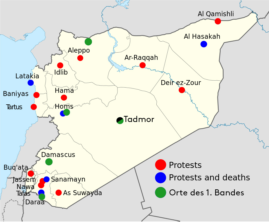
Syrische Proteste 2011
Orte der Proteste in Syrien (2011, Wikipedia)
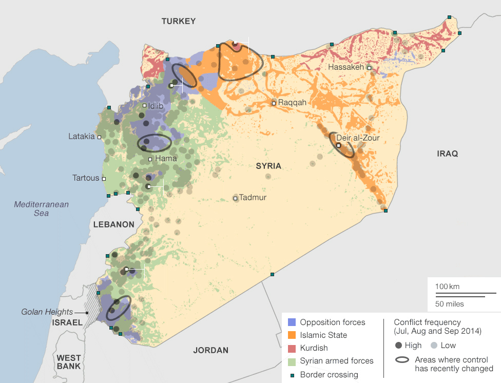
Syrien: Karte der Konflikte
Syria, Mapping the conflict,jJuly to september 2014
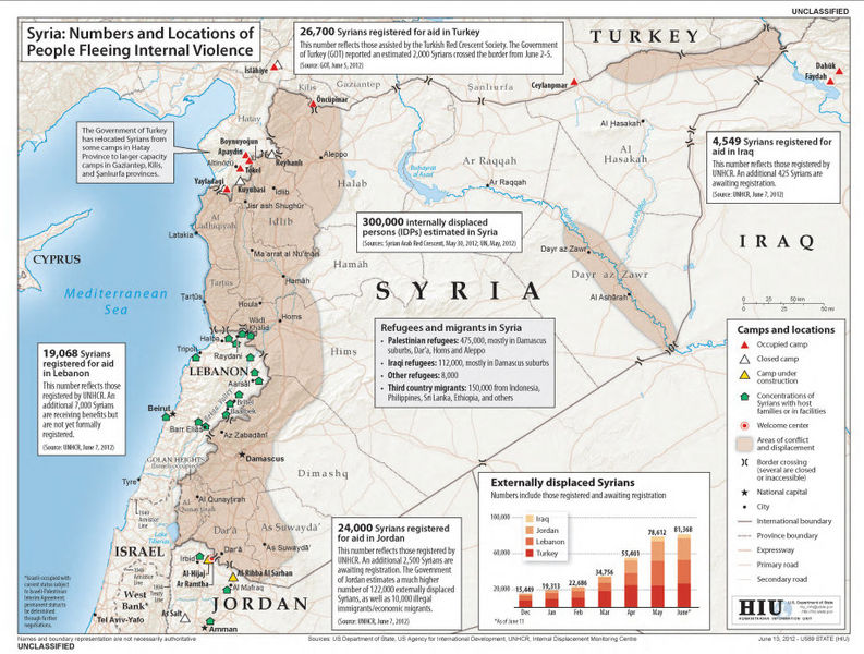
Karte syrischer Fuechtlinge (JUni 2012)
US State Department map of the numbers and locations of people fleeing the violence in Syria during the Syrian uprising. 15 June 2012.
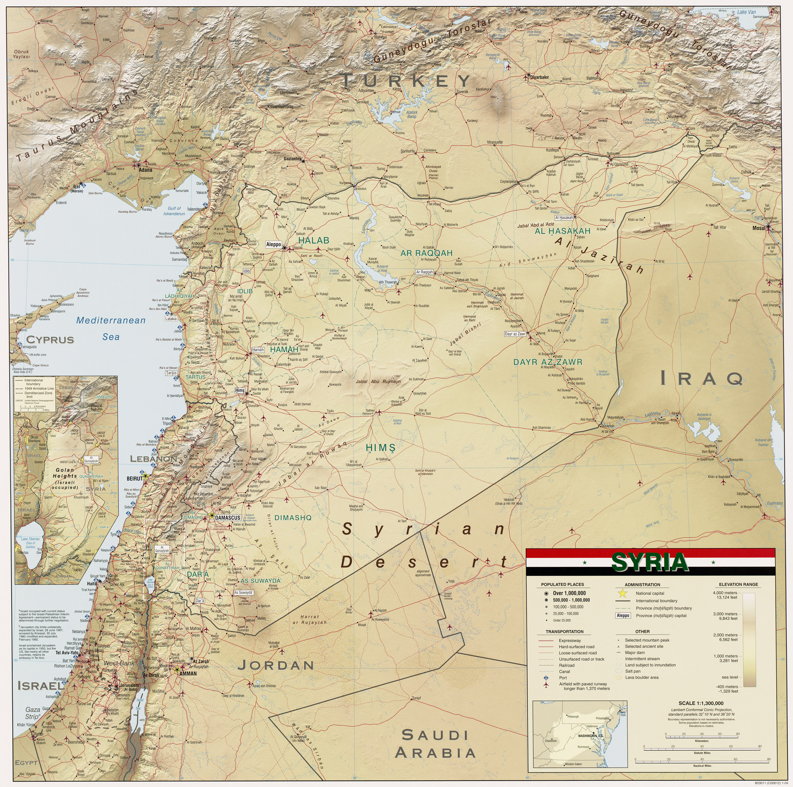
Geographische Karte Syrien
Geographische Karte Syrien von 2004
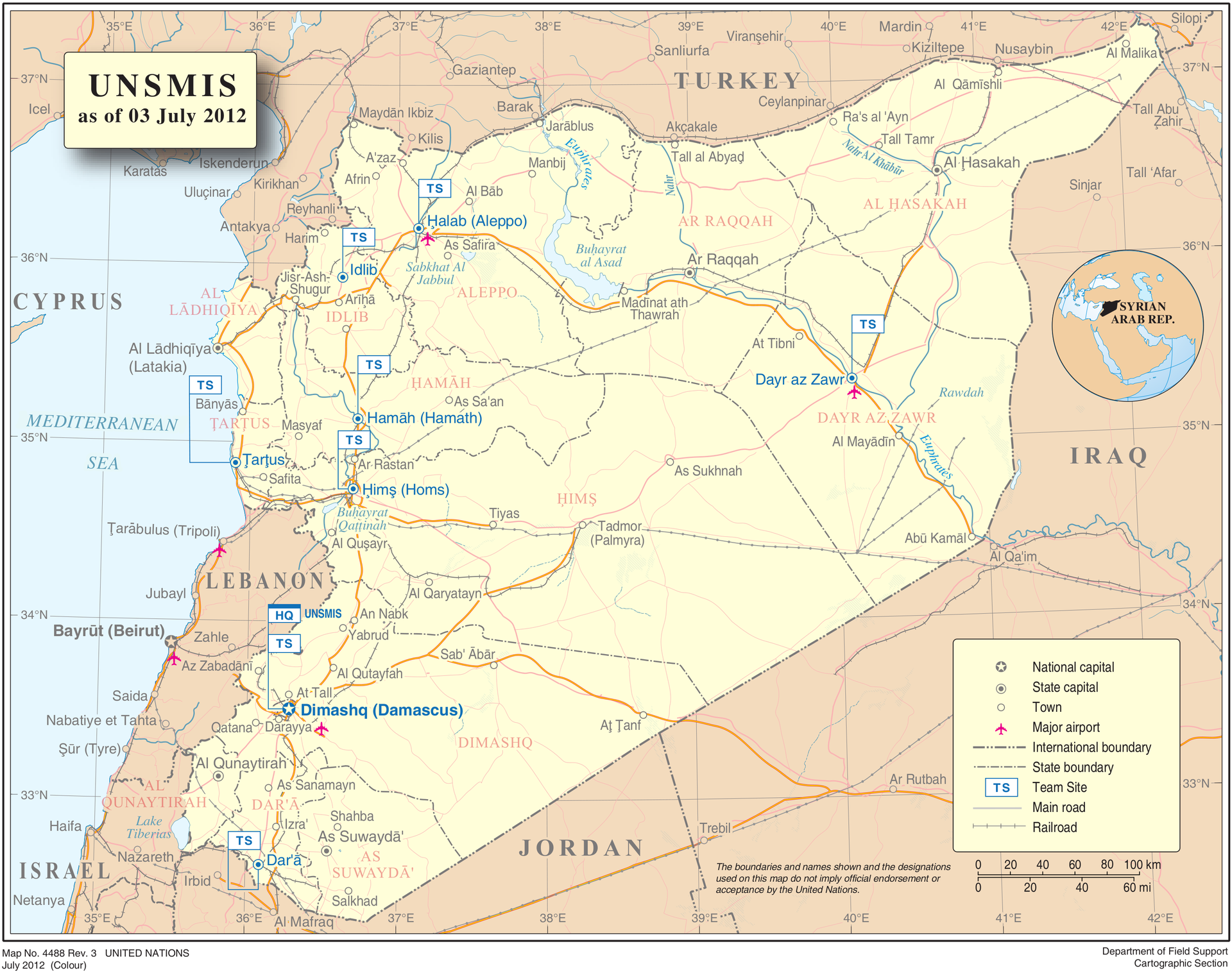
Geographische Karte Syrien
Geographische Karte Syrien der UN von 2012
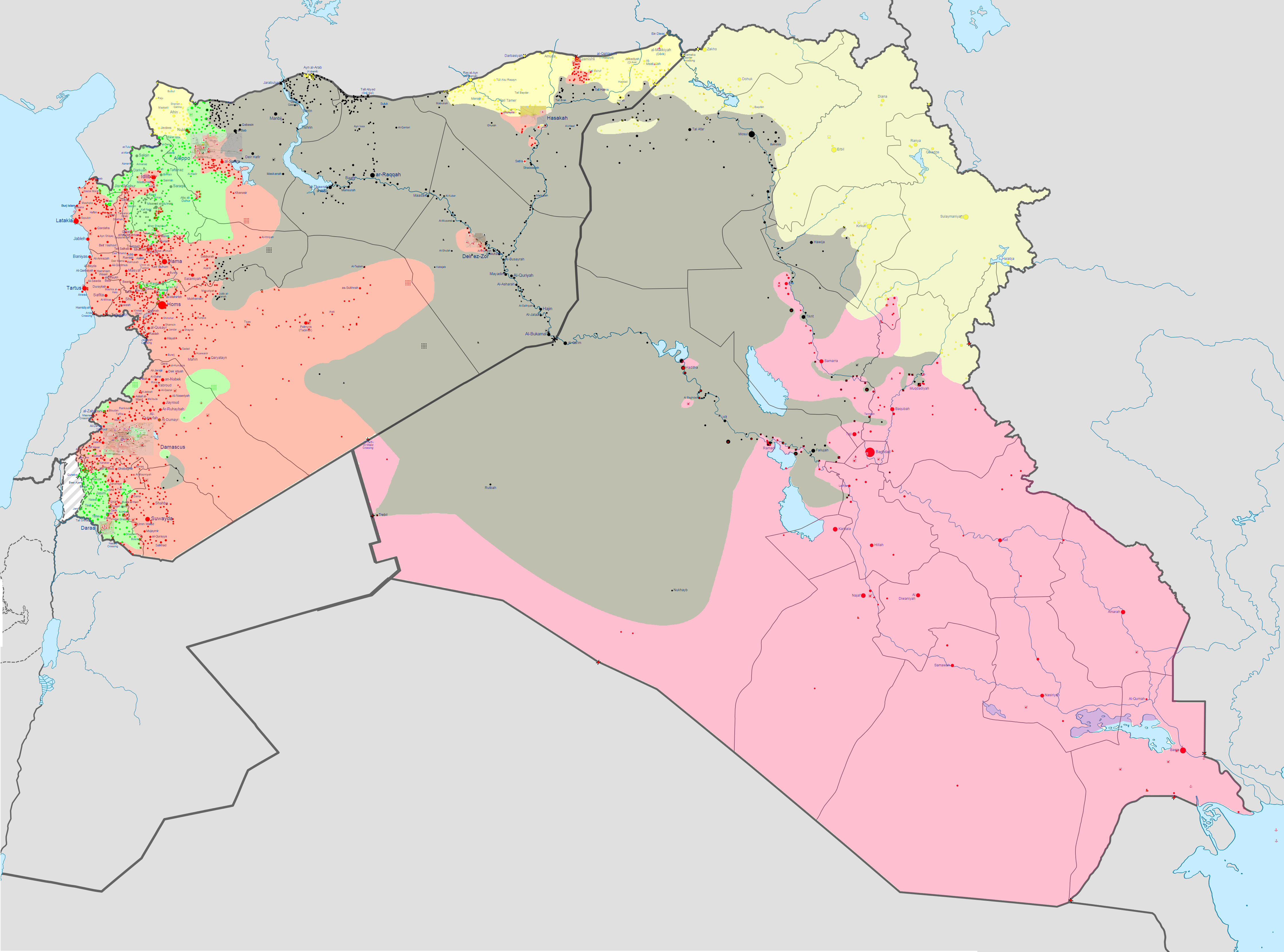
Iraqi Insurgency and Syrian Civil War
Iraqi Insurgency and Syrian Civil War (Wikipedia, Dezember 2014)
Unterst
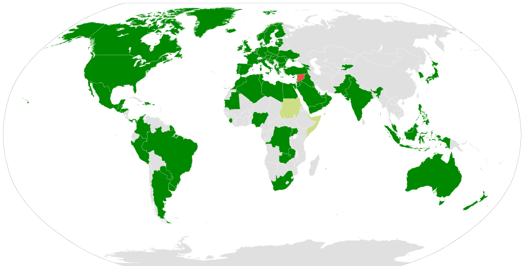
International recognition (green) of the opposition National Coalition as the legitimate government of Syria (red). Chartreuse = other international support.
Der Titel der folgenden Karte lautet:
"International recognition (green) of the opposition National Coalition as the legitimate government of Syria (red). Chartreuse = other international support.""
Man findet hierzu folgende Notiz:
"The accuracy of this map is disputed for the following reason(s): Source? I can tell for sure that Iraq, Lebanon and Syria are officially pro-Assad."
Dass Syrien pro-Assad ist, ist nicht weiter erstaunlich, wenn man Syrien als von Assad regiert definiert. Zum Libanon und dem Irak findet man im Internet zahlreiche Artikel wie...http://www.zeit.de/politik/ausland/2012-10/syrien-hassan-feuergefechte